Mountain Biking Trails

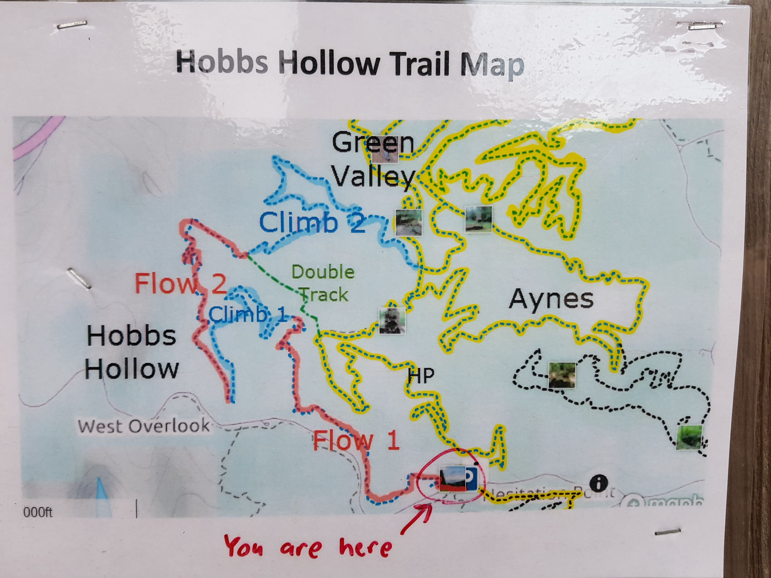
There are nearly 30 miles of beginner to expert mountain biking trails, with 400 feet of elevation change. Trails (mostly singletrack) wind around hills, through ravines and across streams.

The main trailhead is at the parking lot south of the Swimming Pool. There are also access points near the North Lookout Tower, Hesitation Point, Hoosiers Nest Shelter and the Rally Campground.

Trails are built and maintained by volunteers from the Hoosier Mountain Bike Association.

An Off-Road Cycle permit is required to ride any mountain bike trails that are rated above Beginner. Annual permits are $20, daily permits are $5, and these can be purchased at the gatehouse, park office, or online at www.innsgifts.com.

Mountain Biking Trailhead south of swimming pool

Mountain Bike Trails

The following trails are labeled on the Park Map:

A) North Gate Trail (1.2 miles) - Beginner
B) North Tower Loop (3.5 miles) - Beginner
C) Aynes Loop (3.4 miles) - Intermediate
D) Hesitation Point Trail (2.1 miles) - Advanced
E) Pine Loop (1.2 miles) - Beginner
F) Walnut Trail (2.1 miles) - Advanced
G) Limekiln Trail (2.4 miles) - Beginner
H) Schooner Trace (4.1 miles) - Expert
I) Green Valley Trail (5.0 miles) - Intermediate
J) Bobcat Loop (2.0 miles) - Expert
K) Weedpatch (2.4 miles) - Intermediate
L) Ten O'Clock Line (2.0 miles) - Advanced
M) Hobbs Hollow (3.4 miles) - Expert
N) Shelley (2.0 miles) - Intermediate
O) Limekiln East (1.6 miles) - Beginner
P) West Gate (1.1 miles) - Beginner
Q) Gnawbone (1.1 miles) - Advanced

Mountain Biking Trail

Mountain Bike Trail Safety

Mountain biking has inherent risks. To reduce your risk:

- Make sure your mountain bike is in good working order.
- Wear a helmet. 
- Be self sufficient. Bring tools, tubes, food, water, maps and a cell phone.
- Ride within your ability. Don't be afraid to walk. Trails change over time. Be ready for changes to the trail like downed trees and rocks that have moved.
- Slow down when passing other trail users.
- Mountain bikers yield to runners, hikers and equestrians (horseback riders).
- Mountain bikers going downhill yield to riders going uphill. Yield means slow down and be prepared to stop.
- Ride with someone.

Mountain Bike Trail Maps

- Paper maps available at the gate house or here.
- Waterproof maps for sale at local retailers.
- An easy bike map that prints on one sheet of paper (created by a mountain biker) available for download at browncountybikemap.com
- Various maps available online through the Maprika app.

If you load the Maprika app onto your smart phone:

- The app shows your location on the park map.
- You can send your location by email.
- You can use the app to report trail issues by sending an email and photo of the issue to BCSPtrailissues@hmba.org

Hobbs Hollow Trail Map

NOTE: RVs & vehicles towing trailers must use the West Gate Entrance (off S.R. 46, west of Nashville).
The North Gate Covered Bridge is restricted to 9 foot height and 3 ton weight limits.
Horsemen's Campground users should use the entrance off 135 South.


Note: This is not the official Park website. However, it is the most complete and easy-to-use site, with everything you need to plan a trip to Brown County State Park.

Copyright 2003-2024 The Technological Edge, Inc. All rights reserved.